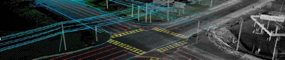
There is several ways to calibrate LiDAR Data wheather it is from a Optech, Leica or Reigl system. The two most common ways are by flying a mission calibration over the base of operation or a cross flight over the project area during the mission. The calibration issues can be resolved using both. The common elements that need to be examined are the Pitch, Roll, Scan factor and heading. The heading usually holds but in some cases it doesn’t but this is rare. The roll and Scan factor or torsion can vary and are directly related. Some refer to torsion or Scan factor as Mirror scale. The roll and mirror scale are directly related and can be preceived as the same thing so it is important to understand these. The mirror scale reflects a smile or frown in the data when profiling across a scan and a roll is inidcated as a uniform linear offset at each end of a scan when two scans are flown in opposite directions of eachother. Mirror Scale seems to be less frequent in the Leica systems. The pitch error is usually represented but offsets in flight direction. The easiest way to identify a pitch error is to profile a builing in overlapping scan areas or in two opposing overlapping flight lines. The pitch error will be indicated when a building in one of the scans is offset from the same building in another scan. This should not be confused with Pitch slope error which is when the pitch is correct at nadir of a scan and offset at the edge of a scan. The pitch slope error doesn’t occur with the Optech systems and is something that needs to be addressed in the Leica systems. The heading is a rotational error between scans and is about the vertical axis of the sensor. Heading can be confused with pitch slope error in the leica systems but not with the optech systems. If someone understands more about the reigl systems that information will be welcome.
-

James Wilder Young
Jamie Young has worked in the LiDAR industry for 24 Years. I am currently Executive Vice President of Technology at Pointerra, 3D Data Solved
-
Join 179 other subscribers
Search Topics
Reference Sites
LiDAR Blogs
Profession Blogs
LIDAR Forums
Categories
-
Recent Posts
Archives
- April 2020
- December 2019
- November 2019
- May 2019
- March 2019
- February 2019
- November 2018
- August 2018
- June 2018
- September 2017
- July 2017
- May 2017
- April 2017
- February 2017
- January 2017
- September 2016
- July 2016
- June 2016
- May 2016
- April 2016
- March 2016
- February 2016
- December 2015
- November 2015
- October 2015
- September 2015
- July 2015
- May 2015
- April 2015
- February 2015
- December 2014
- November 2014
- October 2014
- September 2014
- August 2014
- July 2014
- June 2014
- April 2014
- March 2014
- February 2014
- January 2014
- December 2013
- November 2013
- October 2013
- September 2013
- August 2013
- July 2013
- June 2013
- May 2013
- January 2013
- December 2012
- November 2012
- October 2012
- August 2012
- July 2012
- May 2012
- April 2012
- March 2012
- February 2012
- January 2012
- December 2011
- November 2011
- October 2011
- September 2011
- August 2011
- July 2011
- June 2011
- May 2011
- April 2011
- March 2011
- February 2011
- January 2011
- December 2010
- November 2010

Very interesting. How do they calibrate mobile systems?
Mobile systems usually are calibrated by driving around a building in opposite directions and comparing the two representations of the buildings between the two scans. Surveying positions within the two surveys would be helpful as well. i would contact one of the Mobile LiDAR manufacturers to get more detail on the process which they recommend.