LiDAR Workshop -ALASKA

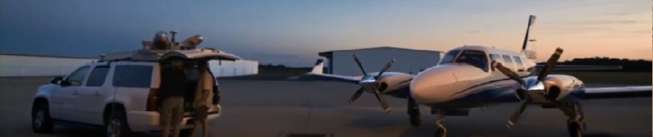
Keith Cunningham and Rob Merry will be holding a Day long LiDAR workshop at the 45th Annual Alaska Survey & Mapping Conference In Anchorage. This workshop will cover several phases of LiDAR and further explain DSM/DTM/DEM, Datums and Coordinate systems among other things. For more details please click on the link below

45th Annual Alaska Survey & Mapping Conference

Posted in DEM/DSM/DTM, lidar events | Leave a comment

LiDAR For Dummies

DLT Solutions and AutoDesk have teamed to release a Book called “LiDAR for Dummies” and it is free. Please click on the link below to sign up for the free book.

Lidar For Dummies

Posted in lidar events, presentations | 6 Comments

LiDAR Ground Filtering- Feature Extraction

This is an interesting paper on Ground filtering along coastal areas. It is posted on LiDAR News and can be found by clicking the link below.

Coastal Filtering

Posted in LiDAR technology, presentations | Leave a comment

DEM-DSM-DTM

I have created a category DEM/DSM/DTM so if you want to just look at information by category and goto the categories pull down on the right and select a category to view such as DEM/DSM/DTM and you will see only the posts for what you are interested in. I am currently working on more information on DEM/DSM/DTM because it seems to be a popular topic.

Posted in DEM/DSM/DTM | Leave a comment

LiDAR News

Please check out the new format of LiDAR news. This is a pretty cool website and LiDAR blog.

LiDAR news

Posted in LiDAR info Sites | Leave a comment

LiDAR Solar Mapping

There has been a lot of interest in using LiDAR for solar mapping. This would be the mapping for placement of solar panels. The slope and aspect of roofs need to be determined in relationship of sun angles at a given location. Recently, New York City conducted a solar mapping project using LiDAR. In addition to solar mapping the data will be used for several other applications. Typically, solar mapping LiDAR projects require a much more dense data set. NYC specified a minumum of 12 points per meter. It is my feeling that a less dense data set would work, maybe 4 points per meter. If anyone has more information on this application or general comments please let me know.

Posted in LiDAR Discussions, Lidar success stories | Leave a comment

Picture of the day

Mobile LiDAR Intensity Image (click on Image)

Posted in LiDAR Pictures, mobile lidar | Leave a comment

Mission Calibration

There is several ways to calibrate LiDAR Data wheather it is from a Optech, Leica or Reigl system. The two most common ways are by flying a mission calibration over the base of operation or a cross flight over the project area during the mission. The calibration issues can be resolved using both. The common elements that need to be examined are the Pitch, Roll, Scan factor and heading. The heading usually holds but in some cases it doesn’t but this is rare. The roll and Scan factor or torsion can vary and are directly related. Some refer to torsion or Scan factor as Mirror scale. The roll and mirror scale are directly related and can be preceived as the same thing so it is important to understand these. The mirror scale reflects a smile or frown in the data when profiling across a scan and a roll is inidcated as a uniform linear offset at each end of a scan when two scans are flown in opposite directions of eachother. Mirror Scale seems to be less frequent in the Leica systems. The pitch error is usually represented but offsets in flight direction. The easiest way to identify a pitch error is to profile a builing in overlapping scan areas or in two opposing overlapping flight lines. The pitch error will be indicated when a building in one of the scans is offset from the same building in another scan. This should not be confused with Pitch slope error which is when the pitch is correct at nadir of a scan and offset at the edge of a scan. The pitch slope error doesn’t occur with the Optech systems and is something that needs to be addressed in the Leica systems. The heading is a rotational error between scans and is about the vertical axis of the sensor. Heading can be confused with pitch slope error in the leica systems but not with the optech systems. If someone understands more about the reigl systems that information will be welcome.

Posted in LiDAR Discussions, LiDAR technology, Uncategorized | 2 Comments

More on Feature Extraction

The following link provides a look at some feature extraction software developed by eCognition now Trimble.  Please provide feedback if you have any comments about it.

eCognition Feature Extraction

Posted in LiDAR info Sites, LiDAR technology | Leave a comment

Mobile LiDAR BTW!!

The new Optech Lynx M1 system can collect 1,000,000 points per second. I am working on getting some imagery of the data from this system. It is kinda funny since just a year or two ago their Lynx collected 400,000 points per second. Why do we need imagery again and like I can handle that many points on my computer? I guess someone needs to tell me if we have a software package that can handle that many points and if it actually works. The cool thing is that the software guys always figure out how to handle more points, I just wish the hardware guys would slow down so we can get comfortable with the systems we have.

Posted in LiDAR info Sites, mobile lidar | Leave a comment